Property Record
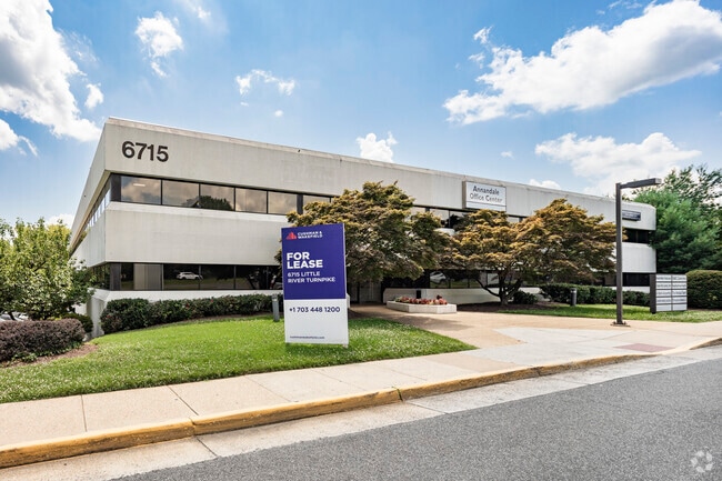
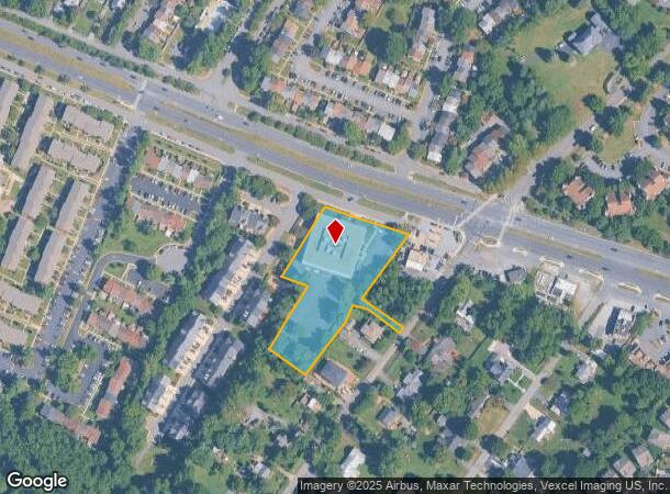
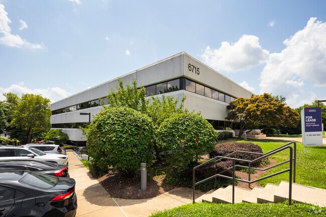
6715 Little River Tpke, Annandale, VA 22003
Current Lease Availabilities
NEARBY LISTINGS FOR SALE OR LEASE
Property Detail
6715 Little River Tpke
Washington-Arlington-Alexandria, DC-VA-MD-WV
Mc Candlish Farr
0712-01-0029A
MC CANDLISH FARR PT LT 12 6599 628
Officebuilding
Fairfax
X
Virginia
5100540050D
29a
2024
2.04 AC
2025
Annandale
452101
Washington, DC
50,621 SF
DEMOGRAPHICS near 6715 Little River Tpke
1 Mile
3 Mile
5 Mile
2024 Total Population
12,019
164,177
468,592
2029 Population
11,924
161,242
461,039
Pop Growth 2024-2029
(0.79%)
(1.79%)
(1.61%)
Average Age
43
39
39
2024 Total Households
3,970
58,203
179,818
HH Growth 2024-2029
(0.98%)
(1.98%)
(1.73%)
Median Household Inc
$135,125
$99,192
$113,537
Avg Household Size
2.80
2.70
2.50
2024 Avg HH Vehicles
2.00
2.00
2.00
Median Home Value
$687,667
$595,580
$637,074
Median Year Built
1971
1969
1972
Nearby Places
Map Layers
Map Styles
 Street
 Aerial
- Restaurants
- Banks
- Shops
- Fitness
- Groceries
PUBLIC TRANSPORTATION
COMMUTER RAIL
Backlick Road (Manassas Line - Virginia Railway Express)
DRIVE
WALK
Distance
Backlick Road (Manassas Line - Virginia Railway Express)
8 min
3.7 mi
Rolling Road (Manassas Line - Virginia Railway Express)
DRIVE
WALK
Distance
Rolling Road (Manassas Line - Virginia Railway Express)
14 min
6.9 mi
Nearby Properties
Address
Land Use
TOTAL SIZE
Lot Size
Zoning
Address
Land Use
TOTAL SIZE
Lot Size
Zoning
613,844 SF
499
Address
Land Use
TOTAL SIZE
Lot Size
Zoning
512,045 SF
12.94 AC
CDD#4
Address
Land Use
TOTAL SIZE
Lot Size
Zoning
60.60 AC
CDD#4
Address
Land Use
TOTAL SIZE
Lot Size
Zoning
1,031,040 SF
36.16 AC
220
Address
Land Use
TOTAL SIZE
Lot Size
Zoning
30 AC
CDD#4
Address
Land Use
TOTAL SIZE
Lot Size
Zoning
853,724 SF
32.32 AC
220
Address
Land Use
TOTAL SIZE
Lot Size
Zoning
429,735 SF
20 AC
560
Address
Land Use
TOTAL SIZE
Lot Size
Zoning
328,506 SF
2.47 AC
CDD#17
Address
Land Use
TOTAL SIZE
Lot Size
Zoning
329,637 SF
23.39 AC
316
Address
Land Use
TOTAL SIZE
Lot Size
Zoning
5 AC
RC
Address
Land Use
TOTAL SIZE
Lot Size
Zoning
1 SF
6.68 AC
RC
Address
Land Use
TOTAL SIZE
Lot Size
Zoning
3,504 SF
3.37 AC
400
Address
Land Use
TOTAL SIZE
Lot Size
Zoning
431,097 SF
16.45 AC
220
Address
Land Use
TOTAL SIZE
Lot Size
Zoning
452,682 SF
20.74 AC
220
Address
Land Use
TOTAL SIZE
Lot Size
Zoning
396,922 SF
11.32 AC
CDD#4
Address
Land Use
TOTAL SIZE
Lot Size
Zoning
415,368 SF
21.06 AC
220
Address
Land Use
TOTAL SIZE
Lot Size
Zoning
485,839 SF
22.59 AC
460
Address
Land Use
TOTAL SIZE
Lot Size
Zoning
485,499 SF
19.11 AC
220
Address
Land Use
TOTAL SIZE
Lot Size
Zoning
468,820 SF
10.22 AC
CDD#4
Address
Land Use
TOTAL SIZE
Lot Size
Zoning
8.03 AC
RC
Address
Land Use
TOTAL SIZE
Lot Size
Zoning
511,000 SF
34.16 AC
596
Address
Land Use
TOTAL SIZE
Lot Size
Zoning
59,386 SF
10.14 AC
RC
Address
Land Use
TOTAL SIZE
Lot Size
Zoning
14.97 AC
220
Address
Land Use
TOTAL SIZE
Lot Size
Zoning
0.43 AC
R 5
Address
Land Use
TOTAL SIZE
Lot Size
Zoning
313,817 SF
14.31 AC
220
Address
Land Use
TOTAL SIZE
Lot Size
Zoning
10.39 AC
Address
Land Use
TOTAL SIZE
Lot Size
Zoning
253,647 SF
5.99 AC
220
Address
Land Use
TOTAL SIZE
Lot Size
Zoning
263,550 SF
1.78 AC
I
Address
Land Use
TOTAL SIZE
Lot Size
Zoning
5.10 AC
RC
Address
Land Use
TOTAL SIZE
Lot Size
Zoning
325,576 SF
13.06 AC
RA
The World's #1 Commercial Real Estate Marketplace
Connect with us
© 2025 CoStar Group
The information above has been obtained from sources believed reliable. While we do not doubt its accuracy we have not verified it and make no guarantee, warranty or representation about it. It is your responsibility to independently confirm its accuracy and completeness. Any projections, opinions, assumptions, or estimates used are for example only and do not represent the current or future performance of the property. The value of this transaction to you depends on tax and other factors which should be evaluated by your tax, financial, and legal advisors. You and your advisors should conduct a careful, independent investigation of the property to determine to your satisfaction the suitability of the property for your needs.